
The Knox County Growth Plan is changing!
These slides from the Advance Knox consultants provide a comprehensive overview of the process and proposed amendment and were presented at the Oct 2023 meeting of the Growth Policy Plan Coordinating Committee. The county’s page on the Growth Policy Plan contains all of the proposed amendments, appendices, and other official materials, as well as information on past and upcoming meetings. There is a useful online map tool that shows the old and new Growth Plans.
There are changes to the text of the Growth Plan (policies) and the actual map. Below is the summary written by KCPA volunteers. Please see the county’s page on the Growth Policy Plan for the most current information, to view public comments, and for up-to-date meeting information.
| Old Plan | New Plan |
| In the Rural Area, limited rezonings to several specific zoning districts (Ag, Estate, Open Spacce, Floodway, Planned Residential at up to 2 du/ac), Planned Commercial and INdustrial | In the Rural Area, limits Placetypes (which in the new comprehensive plan draft are the same as the sector plan designations we’re used to) to Rural Living, Rural Conservation, and Rural Crossroads Commercial. Stated at a meeting, it will also allowed the placetypes of Civic or Institutional, Mining and Heavy Industrial, Park and Open Space. Does not provide a limit for the actual zones that will be allowed in the Rural Area. That will be controlled by a new Unified Development Ordinance, which is a 2024-2025 initiative. |
| In the Rural Area, permitted increase in density of Planned Residential to 3 du/ac if there was provision of water/sewer, it had connecting collector and arterial roads, and a traffic impact analysis demonstrated no impaired traffic flow | In the Rural Area, residential development is limited to no more than 2 du/ac (max, no option for 3 du/ac), sewer and water must be available, and it must be on a collector road with a minimum width of 18 ft. |
| In the Rural Area, could be rezoned for Business Parks | In the rural area, rezonings for industry or business parks are prohibited |
| Planned Growth Area and Urban Growth Boundary | No significant changes. All land use (Placetypes) and zones are allowed. The Growth Plan does not specify density limitations. Note that the 2003 Knoxville-Knox County Comprehensive Plan has policy limits on density in the Planned Growth Area. The draft Advance Knox comprehensive plan, which will replace the 2003 plan, does not contain any density limits. Those could be specified in a Unified Development Ordinance, but that project has not yet kicked off. |
Growth Plan Map Changes
The updated Growth Plan Map starts with including all of the prior Planned Growth Area. If it was Planned Growth in 2001, it is still Planned Growth; there is no retraction. Then, it proposes extending the Planned Growth Area in approximately 6 areas (acreages from proposed Appendix D):
- Washington Pike: 5,952 acres
- Gibbs: 819 acres
- Hardin Valley: 2,957 acres
- Karns: 160 acres
- Chapman Highway: 589 acres
- Strawberry Plains: 384 acres
Below are images showing the existing and new Growth Plan areas, current as of October / November 2023, based on the interactive map published online.
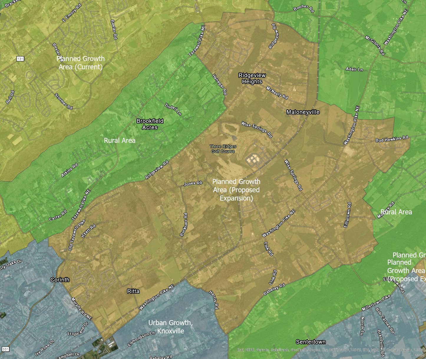
Ritta / Washington Pike
About 5,950 acres along Washington Pike from Murphy Rd out towards McGinnis Road, and bounded on the north by Ridgeview Road.
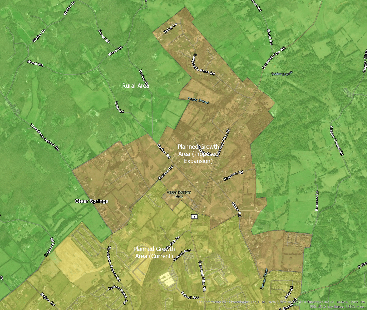
North Gibbs
About 820 acres north of the Gibbs Schools and Gibbs Ruritan Park
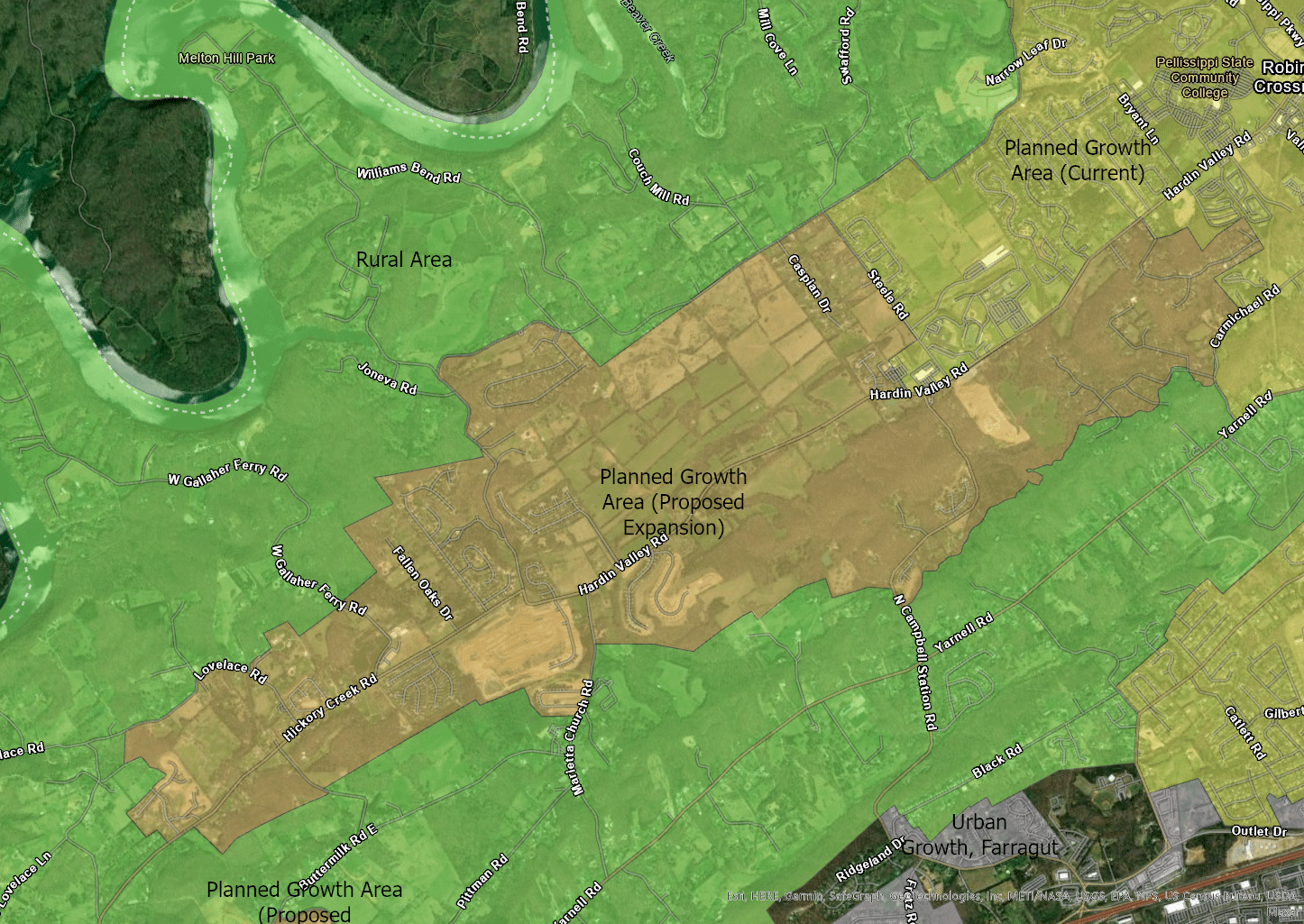
Hardin Valley
2,960 acres of Hardin Valley, from Steele Rd to Nora Mae Rd
North Karns
About 160 acres in Karns, including the Knox County Sportsplex

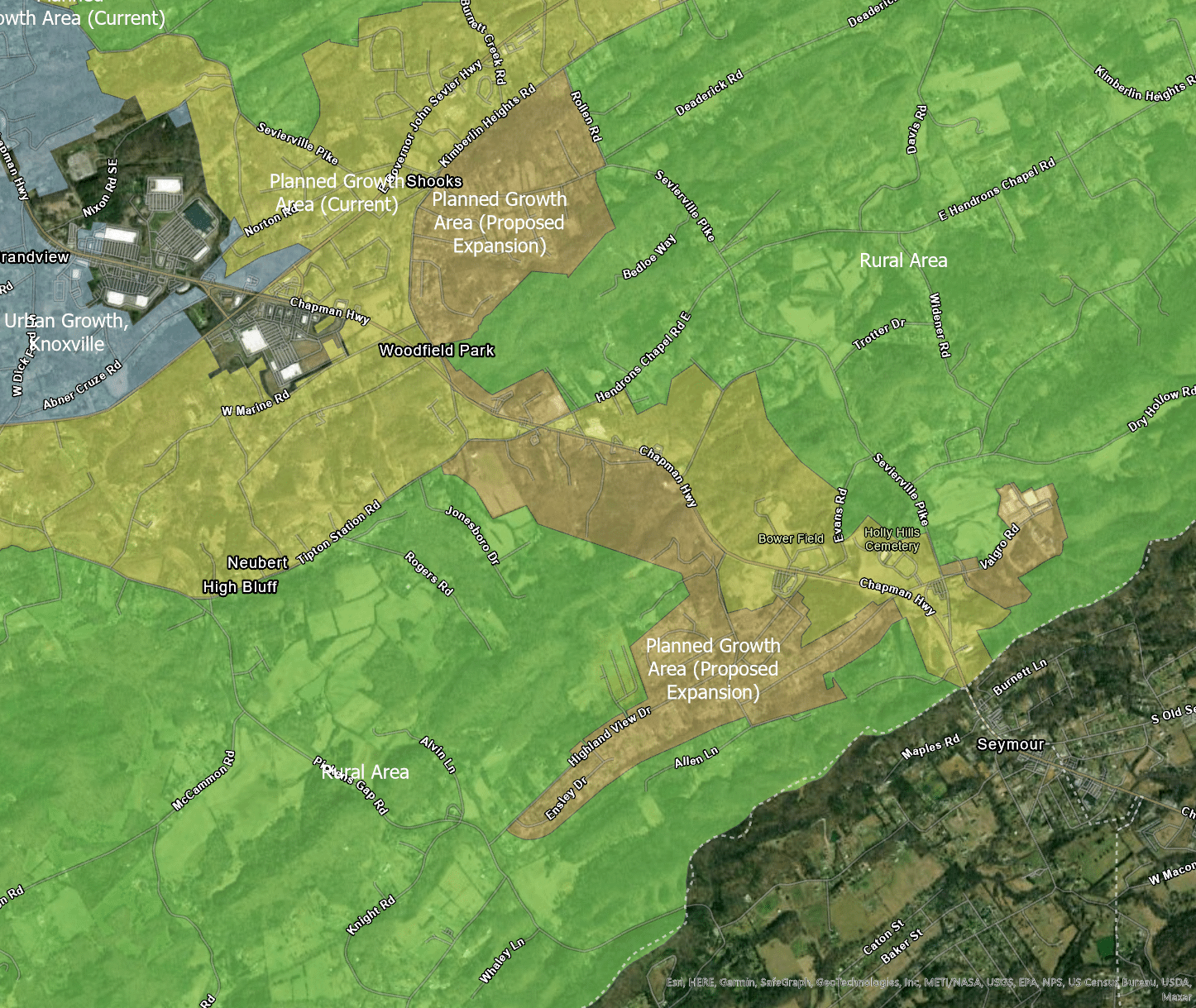
Southern Chapman Highway
Approximately 590 acres along southern Chapman Highway, including a portion south of Kimberlin Heights Rd
Strawberry Plains Rd south of I-40
384 acres on the south side of Strawberry Plains and I-40
